3, సెప్టెంబర్ 2015, గురువారం

Krishnapuram: Buddhist Rock cut Cisterns near Padmanabham

A Buddhist ruin site is located at Krishnapuram village near Padmanabham in Visakhapatnam district of Andhra Pradesh. The site is located on a 50 meter high flat terraced hillock.

Satellite Imagery of Krishnapuram Buddhist site (in yellow)
(Coordinates: 17°59'15"N   83°20'57"E)

This site was explored by me(N. Aditya Madhav) on 19th August 2015 and a team of historical enthusiasts visited the site on 23rd August 2015. The site Photographs were observed by freelance archaeologists and was identified as a site in connection to rock cut cisterns to store rain water during Buddhist times, mostly contemporary with nearby sites of  Pellikonda, Pavurallakonda, Cherukupalli and Gudiwada dibba.

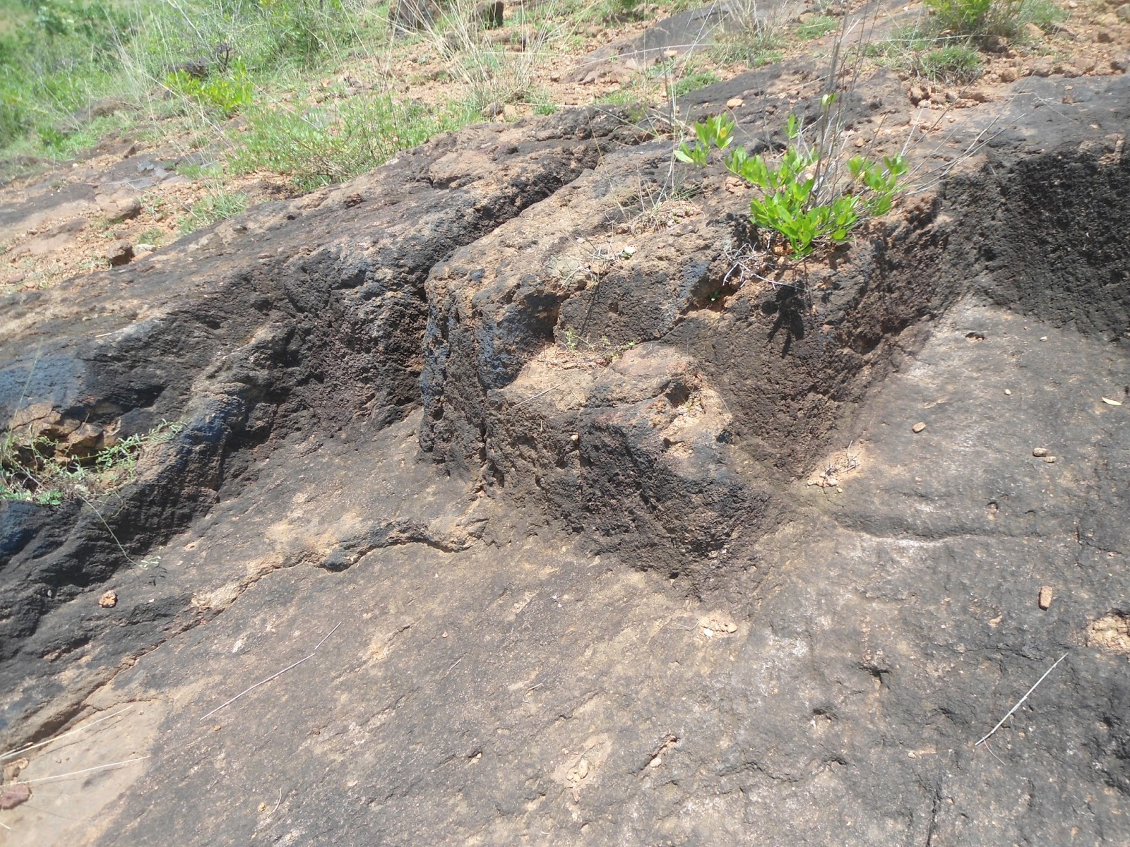
Traces of a Rock cut cistern

Some traces of rock cut cisterns, water channel were found towards west side of the hillock facing the river Gosthani, which is 0.5 KM away. There was a small drain towards the foot of the hill, which merges into the river Gosthani. 

View of the Hillock

Historical Enthusiasts at the Site

Another Rock cut cistern and channel on the hillock

The rock cut cisterns were filled with gravel and we were unable to detect the exact shape or cluster. This site is on the opposite side of Pellikonda Buddhist site. A letter has been sent to the concerned state archaeological authorities to confirm the date of the site. Hope this site gets some attention and goes through detailed exploration very soon.

Help Save Historical Sites of North Coastal Andhra

22, జులై 2015, బుధవారం

Kambalakonda Sanctuary: The Natural protector of Visakhapatnam

The Kambalakonda Wildlife Sanctuary is a forest located near Visakhapatnam. It is under the control of Andhra Pradesh Forest Department since March 10, 1970. Earlier the land was under the control of Maharajah of Vizianagaram. It was named after the local hillock Kambalakonda. It is a dry evergreen forest mixed with scrub and meadows and covers an area of 70.70 square kilometers. Eastern Ghats form the world's 7th Unique Bio diverse region and Kambalakonda lies along the Eastern Ghats Mobile Belt.

Schematic Map of Kambalakonda Wildlife Sanctuary  ( Not to Scale)

The sanctuary has a dry evergreen forest mixed with scrub and meadows. The terrain is hilly with steep slopes. Madhurawada Dome in Eastern Ghats mobile belt is formed by a tectonic arrangement with Khondalite suite and Quartz Archean rocks along the Eastern Ghats north of Visakhapatnam city, Andhra Pradesh, India. This area is a dry evergreen forest Zone. Madhurawada Dome along the Eastern Ghats Mobile Belt is an important region of Biodiversity and a barrier for sea erosion's on the city scape of Vizag.


Today the area of Madhurawada Dome is facing a serious threat of deforestation due illegal constructions in the name of expansion of the city. Lets take up the ecological responsibility for the conservation of Eastern Ghats Mobile Belt (EGMB) . The EGMB acts as a natural protector for the city of Visakhapatnam on the north and west of the city. Lets come together to protect the Eastern Ghats of India.


Eastern Ghats are the natural protectors for the East coast region of India